


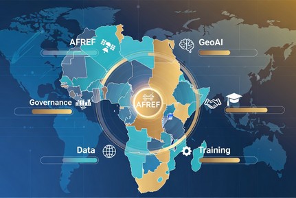
Après avoir posé le diagnostic, souligné la nécessité d’une souveraineté algorithmique, et mis en lumière l’importance stratégique de l’AFREF, ce billet présente l’African Geospatial Development Index (AGDI) comme l’outil indispensable pour mesurer, suivre et piloter la transformation géospatiale du continent.
Pourquoi l’Afrique a besoin d’un index continental ?
Dans un contexte où le géospatial devient une couche stratégique des politiques publiques (infrastructures, résilience climatique, administration foncière, GeoAI), l’absence d’un mécanisme unifié limite la capacité des décideurs à évaluer les progrès, identifier les écarts et allouer efficacement les ressources. L’AGDI comble ce vide et servira de base au nouveau Plan d’Action Africain 2026-2035.
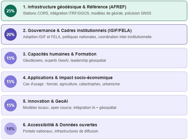
Structure et pondération proposée de l’AGDI
L’index est composé de six piliers avec une pondération qui reflète les priorités stratégiques actuelles:
| Pilier | Pondération | Contenu principal |
|---|---|---|
| 1. Infrastructure géodésique & Référence (AFREF) | 25% | Stations CORS, intégration ITRF/GGOS, modèles de géoïde, précision GNSS |
| 2. Gouvernance & Cadres institutionnels (IGIF/FELA) | 20% | Adoption IGIF et FELA, politiques nationales, coordination inter-institutionnelle |
| 3. Capacités humaines & Formation | 15% | Géodésiens, experts GeoAI, leadership géospatial |
| 4. Applications & Impact socio-économique | 15% | Cas d’usage (foncier, agriculture, catastrophes, urbanisme) |
| 5. Innovation & GeoAI | 15% | Modèles locaux, open source, intégration IA + géospatial |
| 6. Accessibilité & Données ouvertes | 10% | Portails nationaux, infrastructures de diffusion |
Niveaux de maturité :
Initial (0-25) , Développé (26-50) , Avancé (51-75) , Exemplaire (76-100)
Cette pondération met AFREF comme fondation technique incontournable et GeoAI comme levier d’innovation et de souveraineté algorithmique.
Valeur ajoutée de l’AGDI
- Benchmarking entre pays et suivi annuel des progrès du développement Géospatial.
- Outil de redevabilité pour les gouvernements, la CEA et les partenaires techniques.
- Base pour l’allocation des ressources (fonds continental pour renforcer AFREF ou les capacités GeoAI dans les pays en retard).
- Lien direct avec l’Agenda 2063 et les ODD.
Recommandations concrètes pour la 12ieme Réunion
- Créer et Adopter officiellement l’AGDI comme outil de mesure continental.
- Confier à la CEA la mise en place d’un mécanisme de collecte et de validation des données.
- Intégrer l’AGDI dans les rapports nationaux et le futur Plan d’Action 2026-2035.
- Lancer une première édition pilote en 2027 avec un groupe de pays volontaires.
- Associer l’AGDI à un tableau de bord continental accessible en open data.
Conclusion
L’AGDI n’est pas un simple index technique. C’est un instrument de souveraineté qui permettra à l’Afrique de mesurer concrètement ses progrès vers une infrastructure géospatiale robuste, une gouvernance efficace et une innovation GeoAI souveraine.
En combinant une fondation solide (AFREF) et une capacité d’innovation (GeoAI), le continent pourra transformer son intelligence spatiale en véritable levier de développement durable et d’autonomie stratégique.
Prochain billet (Billet 5) : Des cadres aux pratiques : Leçons des expériences nationales et mise en œuvre de IGIF et FELA en Afrique.
https://medium.com/@danny_54172/african-geospatial-data-infrastructure-agdi-initiative-d83d4606badd

https://www.youtube.com/watch?v=6gxhXAeTKmc&t=112s
The African Geospatial Development Index (AGDI): A Continental Tool for Monitoring, Steering and Accountability
Following the previous briefs on algorithmic sovereignty, the strategic importance of AFREF, and the urgent need to revise the African Action Plan, this fourth brief introduces the African Geospatial Development Index (AGDI) as the essential tool to measure, track, and drive Africa’s geospatial transformation.
Why Africa Needs a Continental Index?
In a context where geospatial information is becoming a strategic layer of public policy (infrastructure, climate resilience, land administration, GeoAI), the absence of a unified monitoring mechanism limits decision-makers’ ability to assess progress, identify gaps, and allocate resources effectively. The AGDI fills this gap and will serve as a foundation for the new African Action Plan 2026-2035.
Proposed Structure and Weighting of the AGDI
| Pillar | Weight | Main Content |
|---|---|---|
| 1. Geodetic Infrastructure & Reference (AFREF) | 25% | CORS stations, ITRF/GGOS integration, geoid models, GNSS accuracy |
| 2. Governance & Institutional Frameworks | 20% | IGIF and FELA adoption, national geospatial policies, inter-institutional coordination |
| 3. Human Capacities & Training | 15% | Trained geodesists and GeoAI experts, academic programmes, geospatial leadership |
| 4. Applications & Socio-Economic Impact | 15% | Use cases (land administration, precision agriculture, disaster management, urban planning) |
| 5. Innovation & GeoAI | 15% | Local GeoAI solutions, models trained on African data, open source, AI + geospatial integration |
| 6. Open Data & Accessibility | 10% | Open geospatial data availability, national portals, dissemination infrastructure |
Maturity levels:
Initial (0-25), Developed (26-50), Advanced (51-75), Exemplary (76-100)
Added Value of the AGDI
- Benchmarking between countries and annual Geospatial Development progress tracking.
- Tool for accountability for governments, ECA, and technical partners.
- Basis for resource allocation (continental fund to strengthen AFREF or GeoAI capacities).
- Direct link with Agenda 2063, the SDGs, and preparations for the 12th UN-GGIM: Africa Meeting.
Key Recommendations for the 12th UN-GGIM: Africa Meeting
- Create and officially adopt the AGDI as a continental measurement tool.
- Entrust the ECA with establishing a data collection and validation mechanism.
- Integrate the AGDI into national reports and the future African Action Plan 2026-2035.
- Launch a pilot edition in 2027 with a group of volunteer countries.
- Associate the AGDI with an open-access continental dashboard.
Conclusion
The AGDI is not merely a technical index. It is a tool of sovereignty that will enable Africa to concretely measure its progress toward a robust geospatial infrastructure, effective governance, and sovereign GeoAI innovation.
Next Brief (N°5): From Frameworks to Practice: Lessons from National Experiences and Implementation of IGIF and FELA in Africa
